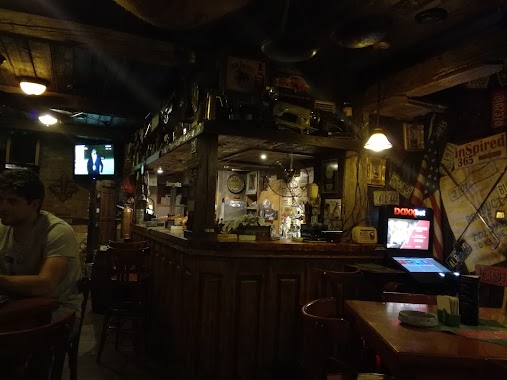
Bar nearby Full House Cafe
Slovakia
Bar nearby Full House Cafe
Full House Cafe
34, Medveďovej, 851 04, Bratislava V, Bratislavský kraj, SK Eslovaquia
contacts phone
:
+421
Latitude:
48.1218971
, Longitude:
17.1301797
larger map & directions
read more
nearest Bar
214 m
Petržalská piváreň
Ovsištské námestie 1, Petržalka
Bar
read more
285 m
Futbal klub
Pankúchova 4
Bar
read more
331 m
Espresso Fortuna
Bulíkova 3152/27, Petržalka
Bar
read more
585 m
Starohájska piváreň
Haanova 3153/52, Petržalka
Bar
read more
705 m
Hardy Pub
Šustekova 9, Petržalka
Bar
read more
738 m
Šenk
Haanova 3388/12, Petržalka
Bar
read more
792 m
Espresso u Magistra
Šustekova 3150/35, Petržalka
Bar
read more
892 m
Petržalská Klubovňa
Starohájska 2, Petržalka
Bar
read more
942 m
Micho Gusto café y tapas
Dudova, Petržalka
Bar
read more
965 m
RATATA
2452, Mlynarovičova 2452/5, Petržalka
Bar
read more
991 m
Gevor PUB
Námestie hraničiarov 1, Petržalka
Bar
read more
1.004 km
Piváreň Bigger Rock Garden
Májová 3303/23, Petržalka
Bar
read more
1.121 km
Gauč Pub
Nám. hraničiarov, 2581 2581/4A, Petržalka
Bar
read more
1.215 km
Herňa a pohostinstvo Kométa
Gessayova 2569/20, Petržalka
Bar
read more
1.355 km
Las Vegas
Farského 3266/24, Petržalka
Bar
read more
1.479 km
Kaviareň Doma je pohoda
ul. Rovniankova 2
Bar
read more
1.642 km
Pivárnička
Rovniankova 2475/7, Petržalka
Bar
read more
1.687 km
The Izzi Pub
Rovniankova 12, Petržalka
Bar
read more
1.69 km
Golf club
Wolkrova 13, Petržalka
Bar
read more
1.837 km
Almira
Hálova 1081/10, Petržalka
Bar
read more
2.105 km
Anjelská Vinotéka
Topoľčianska 3200/8, Petržalka
Bar
read more
2.182 km
Bufet pod školou
Tematínska 3246/10, Petržalka
Bar
read more
2.255 km
LUNAPARK
Holíčska 27, Petržalka
Bar
read more
2.486 km
Caiman cafe bar
Šintavská 3549/26, Petržalka
Bar
read more
2.652 km
Espresso Clip
Budatínska 11, Petržalka
Bar
read more
📑
all categories
Accounting
Administrative area level 1
Administrative area level 2
Airport
Amusement park
Aquarium
Art gallery
Atm
Bakery
Bank
Bar
Beauty salon
Bicycle store
Book store
Bowling alley
Bus station
Cafe
Campground
Car dealer
Car rental
Car repair
Car wash
Casino
Cemetery
Church
City hall
Clothing store
Convenience store
Courthouse
Dentist
Department store
Doctor
Electrician
Electronics store
Embassy
Establishment
Finance
Fire station
Florist
Food
Funeral home
Furniture store
Gas station
General contractor
Grocery or supermarket
Gym
Hair care
Hardware store
Health
Home goods store
Hospital
Insurance agency
Jewelry store
Laundry
Lawyer
Library
Light rail station
Liquor store
Local government office
Locality
Locksmith
Lodging
Meal delivery
Meal takeaway
Mosque
Movie rental
Movie theater
Moving company
Museum
Natural feature
Neighborhood
Night club
Painter
Park
Parking
Pet store
Pharmacy
Physiotherapist
Place of worship
Plumber
Point of interest
Police
Post office
Premise
Real estate agency
Restaurant
Roofing contractor
Route
Rv park, camping
School
Shoe store
Shopping mall
Spa
Stadium
Storage
Store
Subpremise
Supermarket
Synagogue
Taxi stand
Train station
Transit station
Travel agency
University
Veterinary care
Zoo
administrative area level 3
sublocality level 1
↑