Gas station nearby Ecotank stojan
Slovakia
Gas station nearby Ecotank stojan
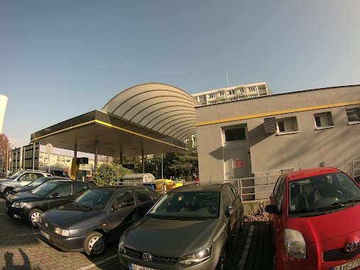
Ecotank stojan
Elektrárenská, 831 04, Bratislava III, Bratislavský kraj, SK Slowakei
contacts phone
:
+421
Latitude:
48.1731229
, Longitude:
17.1496389
larger map & directions
read more
nearest Gas station
19 m
EcoTank
Elektrárenská 1394/4, Bratislava
Gas station
read more
549 m
Shell
Vajnorská 3474/171, Bratislava
Gas station
read more
577 m
Čerpacia stanica Jopi Trade Bratislava
Turbínová 3528/1, Bratislava
Gas station
read more
731 m
Slovnaft
Vajnorská 10574/120A, Bratislava
Gas station
read more
768 m
Shell
Rožňavská 731/6, Bratislava
Gas station
read more
781 m
8205 Bratislava Roznavska
Rožňavská 731/6, Bratislava
Gas station
read more
785 m
Shell
Rožňavská 6
Gas station
read more
981 m
Slovnaft
Tomášikova 36, Ružinov
Gas station
read more
1.019 km
OMV Čerpacie stanice
Rožňavská 17/A, Bratislava
Gas station
read more
1.027 km
OMV
Vajnorská 167, Nové Mesto
Gas station
read more
1.214 km
OMV Čerpacie stanice
Vajnorská 167, Bratislava
Gas station
read more
1.214 km
OMV
Vajnorská 167, Bratislava
Gas station
read more
1.397 km
GIA Slovakia, spol. s r.o.
Vajnorská 135, Nové Mesto
Gas station
read more
1.464 km
Súkromné čerpacie stanice, Bratislava
Galvaniho 4319/2, Bratislava
Gas station
read more
1.492 km
Shell
Drieňová 5421, Bratislava
Gas station
read more
1.557 km
Lpg
Bojnická 6954/19, Bratislava
Gas station
read more
1.629 km
OMV
Račianska ul 66 Bratislava
Gas station
read more
1.629 km
OMV Čerpacie stanice
Račianska ul 66 Bratislava
Gas station
read more
1.686 km
Autoservis
Galvaniho 3972/2A, Bratislava
Gas station
read more
1.711 km
Slovnaft
Vajnorská, Bratislava
Gas station
read more
1.812 km
OMV
Rožňavská 4588/24
Gas station
read more
1.812 km
OMV Čerpacie stanice
Rožňavská 4588/24
Gas station
read more
1.814 km
Slovnaft
Herlianska 1, Bratislava
Gas station
read more
2.025 km
OMV
Trnavská cesta 6, Bratislava
Gas station
read more
2.025 km
OMV Čerpacie stanice
Trnavská cesta 6, Bratislava
Gas station
read more
📑
all categories
Accounting
Administrative area level 1
Administrative area level 2
Airport
Amusement park
Aquarium
Art gallery
Atm
Bakery
Bank
Bar
Beauty salon
Bicycle store
Book store
Bowling alley
Bus station
Cafe
Campground
Car dealer
Car rental
Car repair
Car wash
Casino
Cemetery
Church
City hall
Clothing store
Convenience store
Courthouse
Dentist
Department store
Doctor
Electrician
Electronics store
Embassy
Establishment
Finance
Fire station
Florist
Food
Funeral home
Furniture store
Gas station
General contractor
Grocery or supermarket
Gym
Hair care
Hardware store
Health
Home goods store
Hospital
Insurance agency
Jewelry store
Laundry
Lawyer
Library
Light rail station
Liquor store
Local government office
Locality
Locksmith
Lodging
Meal delivery
Meal takeaway
Mosque
Movie rental
Movie theater
Moving company
Museum
Natural feature
Neighborhood
Night club
Painter
Park
Parking
Pet store
Pharmacy
Physiotherapist
Place of worship
Plumber
Point of interest
Police
Post office
Premise
Real estate agency
Restaurant
Roofing contractor
Route
Rv park, camping
School
Shoe store
Shopping mall
Spa
Stadium
Storage
Store
Subpremise
Supermarket
Synagogue
Taxi stand
Train station
Transit station
Travel agency
University
Veterinary care
Zoo
administrative area level 3
sublocality level 1
↑